Navigation

![]()

![]()
.png)
Pagimi Creek Fire
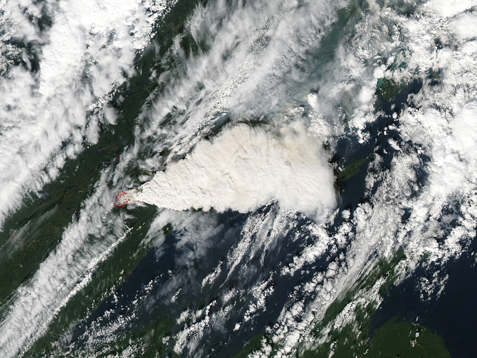 The
Pagami Creek Fire (Superior National Forest - MN) on Sept 9-12 provided
another powerful picture of the perfect storm that combines summer drought,
high pressure and strong cold fronts in the Lake States. Now estimated
at 94,000 acres, the fire moved nearly 15 miles on Sept 12 with winds
gusting to 40 mph and temperatures above 80 degrees F. Though these catastrophic
events can threaten lives and destroy property, the landscape has experienced
them for centuries. Our challenge is to learn from these crown fire disturbances,
evaluate the legacies of these disturbances and variability they create,
and design treatments that can emulate their effects safely and effectively
in management of these ecosystems across the Lake States. Picture on right
taken from NASA's Terra satellite shows smoke from the Pagami Creek fire
in northeastern Minnesota on Monday, Sept. 12, 2011. (Image courtesy NASA)
The
Pagami Creek Fire (Superior National Forest - MN) on Sept 9-12 provided
another powerful picture of the perfect storm that combines summer drought,
high pressure and strong cold fronts in the Lake States. Now estimated
at 94,000 acres, the fire moved nearly 15 miles on Sept 12 with winds
gusting to 40 mph and temperatures above 80 degrees F. Though these catastrophic
events can threaten lives and destroy property, the landscape has experienced
them for centuries. Our challenge is to learn from these crown fire disturbances,
evaluate the legacies of these disturbances and variability they create,
and design treatments that can emulate their effects safely and effectively
in management of these ecosystems across the Lake States. Picture on right
taken from NASA's Terra satellite shows smoke from the Pagami Creek fire
in northeastern Minnesota on Monday, Sept. 12, 2011. (Image courtesy NASA)
View Fire Information from InciWeb
View story from MPRNews from 9/13/11
View pictures from Northland News